Documented observations of rare species in the Highlands Corridor

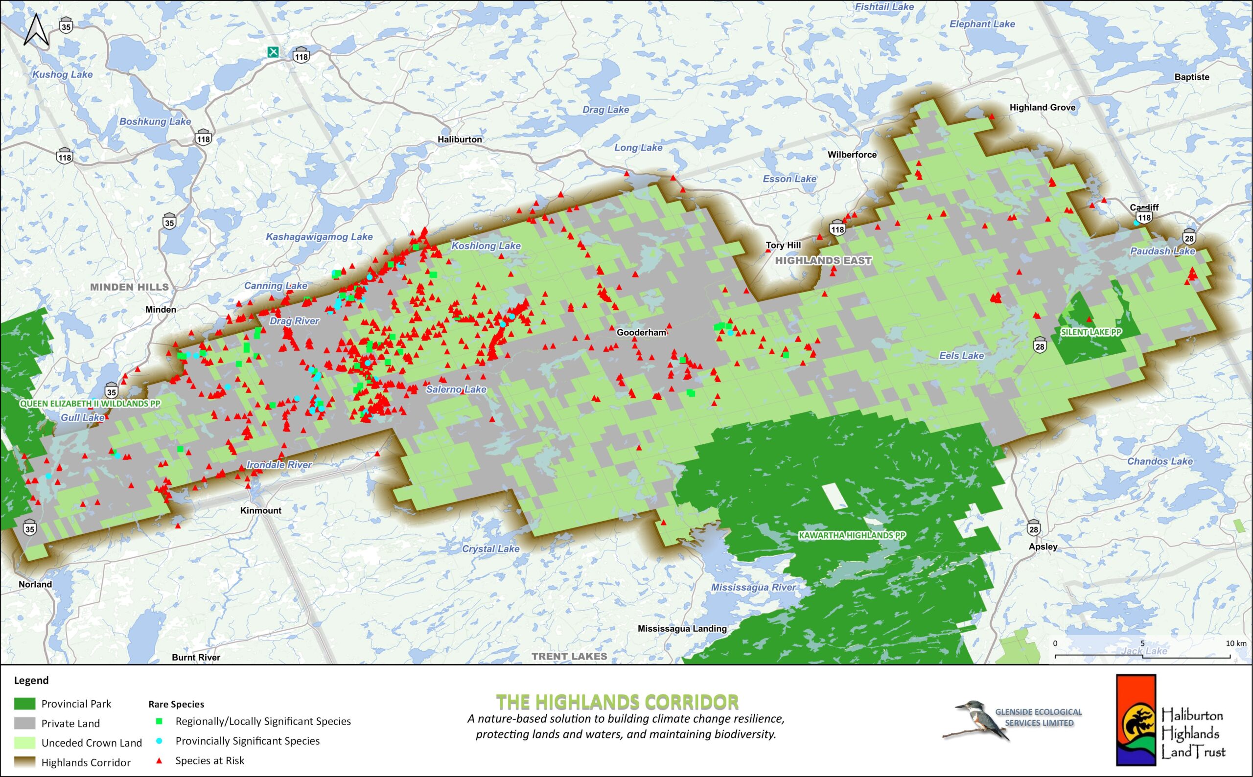
Since 2007, the HHLT has maintained a georeferenced database of species at risk observations. The majority of the records consists of species at risk occurrences documented by project biologists and naturalists during field investigations. Other records include community observations that have been verified by a biologist through consultation and/or review of photo-documentation. The database now houses 3,250 species at risk observations distributed throughout the County of Haliburton and is a valuable tool for conservation planning.
Circuit theory analysis of the Highlands Corridor

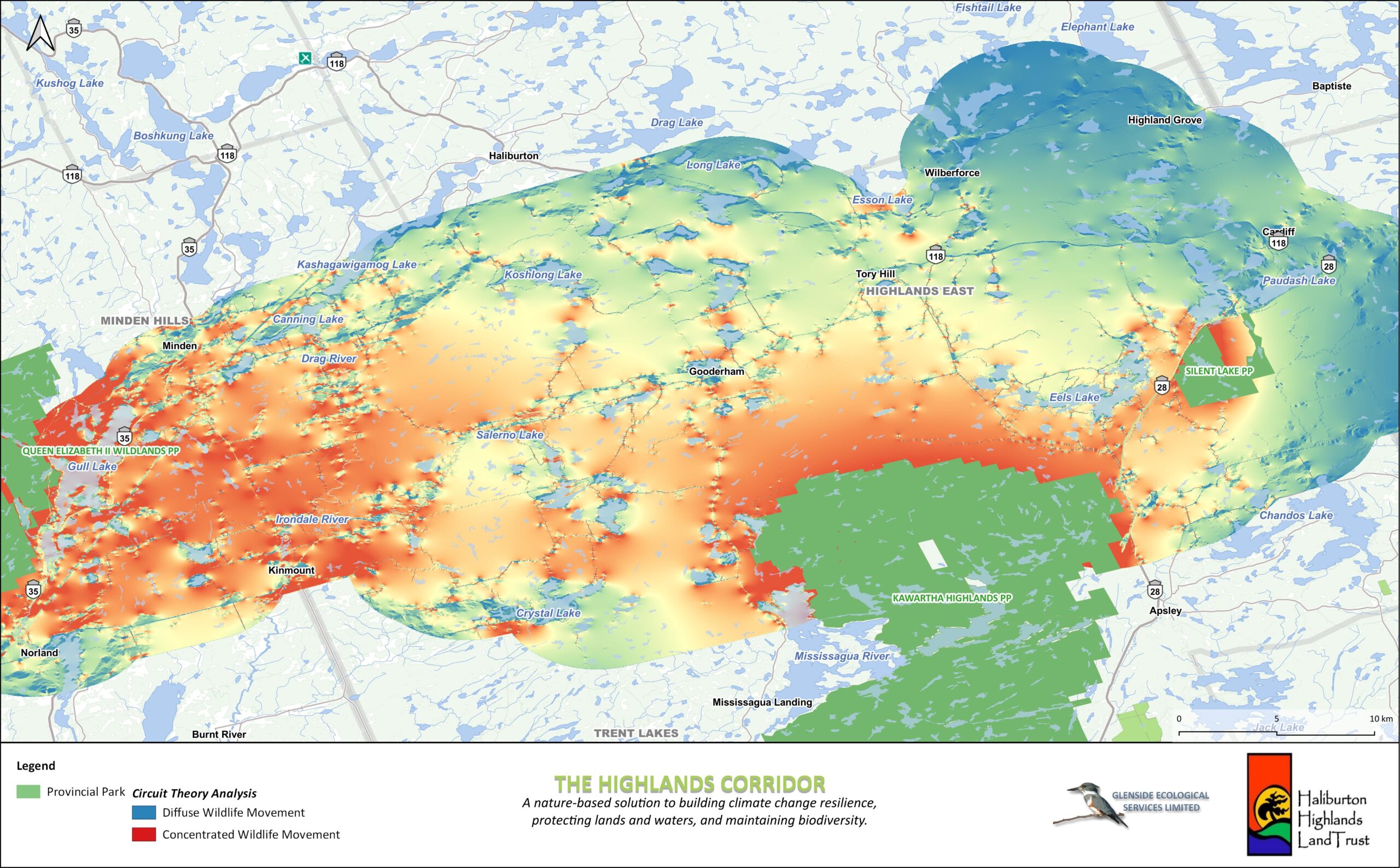
To better understand wildlife movement through the Highlands Corridor and target conservation efforts, the HHLT conducted circuit theory analysis using a highly representative landscape base layer compiled from the HHLT wetland mapping, Forest Resource Inventory (FRI), and Ontario Road Network datasets.
Utilizing ecosite classification, indices of naturalness, permeability and protection were developed and applied to the base map. The analysis was run at a resolution of 25m pixels and identified areas of concentrated wildlife movement as high priority sites for conservation and protection, as they facilitate wildlife movement between Queen Elizabeth II Wildlands Provincial Park, Kawartha Highlands Provincial Park and Silent Lake Provincial Park.
As seen in the map above, the analysis identified diffuse wildlife movement throughout much of the corridor, which is reflective of a broad natural landscape. In the west of the corridor, wildlife movement becomes more concentrated due to a higher component of barriers such as roads, developed areas and large lakes. Protecting and restoring natural habitat in these areas of concentrated wildlife movement will enhance connectivity throughout the corridor and between provincial parks.
